|
| The route follows the rib that extends from the center of the photo up left to left high point (Smith Peak) and then across the summit ridge to the summit pinnacle in the upper center of the photo (6/2011). |
Mt Jefferson has been quite challenging for me to climb. This trip marked the 5th attempt on the peak and the 4th on the Woodpecker approach to Jefferson Park Glacier's knife edge ridge. The first attempt was an early spring ski of the SW ridge thwarted by heavy snowfall at 50+MPH winds. The second attempt was up Woodpecker ridge on skis in late May, which ended with 80F temperatures and large scale wet slab avalanches actively dumping from nearly every aspect. The third attempt ended when my father decided that he did not want to follow my lead on the lower part of the KER and imminent warm temperatures. The
forth attempt was in nearly identical conditions to the third, only a year later. Another late snow year with heavy rime formations, high wind in the morning, and rapid warming during the day. This attempt ended when we were too late and too slow to make the summit. The retreat in isothermic conditions was scary to say the least.
For this trip I met up with Wojtek through Cascade Climbers and we left Portland at 3:30 PM on Friday through the rush hour traffic to Salem. We headed east up OR 22 to Detroit, stopping for some delicious, greasy corn dogs at the local market. The long drive up the one lane dirt road nearly ended two miles short of the trailhead when a VW bug sized rock lay squat in the middle of the road. On previous attempts I had looked at this very rock, perched on the steep cutbank above the narrowest part of the road, and thought about being stuck miles up the road if it fell. Fortunately someone had done some shovel work and we were able to get the truck around block. The rest of the drive was uneventful. Hoping out of the car, I grabbed the chainsaw we had brought in case of trees across the road and walked to stash it in the bushes. They were much wetter than I had hoped, a preview of the bushwhack ahead. The walk up the trail went smoothly without any snow coverage. It was clear that the snow level was much higher than the junction of Woodpecker Ridge trail 3442 with Trail 2000.

The bushwhack was relatively uneventful. The brush seems to be less dense about 100 yards south of the main ridge, especially in creek drainages. We followed these water courses until we found some rocky clearings signifying that we were two thirds of the way up the ridge to treeline from the junction. At this point, the main ridge becomes rockier and more open so it's easier to follow it. There was some flagging and small cairns that I had never seen before because they are usually under the snow. Just short of timberline at 6400', we found a nice flat bivouac site. Wojtek had the brilliant idea of bringing a sleeping bag and ground cloth, so we stretched out the ground cloth and pads. He got to enjoy the sleeping bag for four hours while I shivered, my feet aching in the cold.
 |
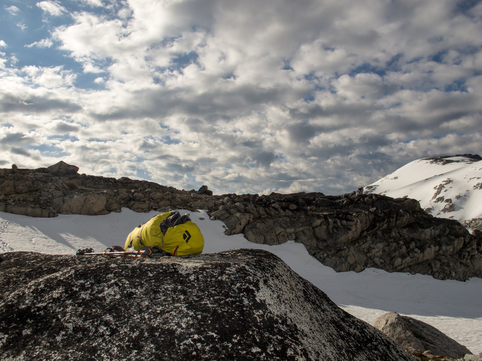
| Camp for four hours after the two hour hike in. |
The clouds lifted above camp just at sunset and by full darkness they were gone. The moon was the brightest and largest I have ever seen climbing, on a cloudless night. After some fitful sleep, I got up 15 minutes early at 12:15 because I couldn't sleep and made breakfast. Chili mac with beef. Yum. Wojtek wasn't feeling the corn dogs from earlier but managed to choke down some rice with chicken. Before 1AM we started moving, leaving the sleeping gear, stove, some layers, and extra food behind. The air temperature was barely above freezing. The post holing began.
 |
| Moon illumination 1AM. |
A thick sun crust had formed, hard to sit on, but fragile enough to break through each step. Depth ranged from 6 inches to almost knee height on the steeper aspects. We made steady progress however, and soon began the long, steep climb to the spur crest. Wojtek wasn't feeling the corn dogs from the night before. Apparently they weren't a good decision, but they sure were tasty.
 |
| Early morning and corn dogs. |
Because the snow conditions were so bad, we worked our way up the rocks, exposed in the low snow conditions. Even this was annoying, however because the rocks were glazed with frost from the clouds of the previous day. Two thirds of the way up the spur, we stopped at the only flat spot on the spur, a snow moat beneath a small 4th class step.
 |
| 1st rest stop. 3AM |
We opted for crampons at this point, a good decision in retrospect because the snow had become hard enough to prevent breaking through and a fall was 1000-2000' depending on which side of the ridge one fell. The short, rotten rock step came and went and soon we were past the Prehistoric monster, a rock feature on Woodpecker ridge at 9200'. The sun was just beginning to light the eastern sky.
We made good time to the Jefferson Park Glacier saddle, reaching a little before actual dawn. The traverse was in good enough conditions to allow ski pole usage, though we did walk across multiple debris fields from previous days. Nearly the whole mountain had obvious avalanche paths that were recently active, likely from the last snowfall. However, everything was either slid or well settled because there was no activity all day.
 |
| Three large volcanoes, Rainier, Adams, and Hood with the edge of the Mohler tooth in the foreground. |
During our short break at the saddle, we noticed three or so headlights moving far below in Mill Creek gully. We knew they were either much faster than us or they would never make it. We geared up, left a pack and the ski poles and made our way up the final 100' to the first belay.
 |
| Can you spot the belayer? 1st pitch of the KER, JPG saddle to the right. |
 |
| Finishing pitch 1. |
We had decided that I would lead the ridge in the interest of speed (I had been there twice before) despite the fact that Wojtek climbs higher grades than I. However, the climbing was easy fifth class, mixed ice. The hardest part of the first pitch is usually a vertical ice hose, but it was nearly gone, only a small blob of ice stuck to the side. Mounting this was a little awkward, but the gear was great and I made short work of it. Wojtek followed quickly, we flipped ropes and I led once again.
 |
| 2nd belay and the coolest part of the ridge. Smith Peak in the background. |
 |
| Beginning of pitch 2. |
The second pitch is by far the coolest, a near perfect slab knife edge in sections. I found the mixed climbing to be particularly fun; chill, but interesting. There was even a solid 13cm screw.
 |
| Wojtek following pitch 2. |
 |
| Mohler Tooth from the KER. |
The final down climb had some interesting drytooling moves, but was well protected and went without issues. I led out as far as the rope would let me and belayed off a solid picket.
The last section of the ridge and the downclimb.
We hoofed it across the final section of the ridge, resting briefly once more. The two bumps on the ridge visible in the previous trip report's
picture had mixed downclimbs on the south side, adding some spice to the traverse, which we did solo to save time.
Reaching the base of the summit pinnacle, we anchored the pack to a nut, I handed the rack to Wojtek, and he took off on a quality lead up steep mixed/rime ice climbing. He also managed to fix a loose crampon thirty feet up.
 |
| Wojtek on pitch one on the north ridge of the summit pinnacle. |
 |
| The end of pitch 1. Photo Wojtek. |
Wojtek led one more solid pitch up varying steepness snow and ice, including a vertical 10' ice step to a belay in the warm morning sun just below the summit. He could have continued to the summit, but he graciously stopped to let me finish the climb. I found quality rock on a 5.6 step up to the final 40' traverse along the ridge. At last I was standing on top, greeted by an open summit register without a lid and soaked, worthless paper. It was 8AM, 7hrs from our camp site at timberline.
 |
| 5.6 fun on warm rock just below the summit. Photo Wojtek. |
 |
| The final few feet to the summit block (foreground). Smith Peak far right, the KER is the dark section of ridge, and the Mohler tooth is at the right (east) end of the KER. |
 |
| Wojtek, a happy man. |
 |
| Someone left and open summit register. Photo Wojtek. |
 |
| The view south. In order of distance, Three Fingered Jack, Mt. Washington, North Sister, Middle Sister, South Sister, Broken Top, Diamond Peak, Mt. Thielson (look carefully). |
 |
| The view north. |
We enjoyed the view for a few minutes and quickly rapped off the south side, as low as our rope would reach. Committing to some sketchy mixed downclimbing on 4th class terrain above the terrible traverse, we reached the West Rib. We grabbed the pack, barely stopping to eat and drink before hauling back to the rappel off the north side of the top end of the KER. I was unable to find our bail slings from last year, nor was I able to find my
cordelette once we reached the saddle between the ridge and Mohler Tooth. The sun was rapidly warming the snow and we needed to get down.
Wojtek walked down as I paid out the rope and he led the downclimb through the mixed ground below.
 |
| Wojtek on the way down, KER to the upper left. |
The exposure here, above JPG is remarkable, but sure feet and clear heads left us smiling at the saddle in 15 minutes. Another break, packing, and a switch to ski poles and we carefully made our way down the steep beginning to the descent under Smith Peak. Soon the angle eased as we continued to the bivouac site below Prehistoric Monster. It was now very warm. I stripped down to long underwear and Wojtek decided to tough it out. We managed to glisade much of the lower bowl that was so ice before, and made it to the bottom in 5 minutes, but not before I twisted my knee because I was too lazy to take off my crampons. The hike out was long, but uneventful. Back at the car by 1PM.
 |
| Lower Woodpecker Ridge. Photo Wojtek. |
Total trip time 20 hrs, including 4 hrs sleep. Two hours bushwhack, 4 hours sleep, 9 hours from timberline, 5 hours down. Conditions were much easier than before, with some solid rock exposed, and generally consolidated rime. There was significant post holing for about 1000' vertical, right above treeline. In a few warm days, the ridge should be almost entirely rock. JPG was very well filled in and the 'schrund looked easily navigable from above (though this could be deceiving). The snow became isothermic by 11am, so plan to be early and fast. Retreat from the Woodpecker approach is somewhat more difficult than the Jefferson Park approach because you have to descend basically the same ridge you climbed on the way up. I highly recommend dropping to the saddle by Mohler tooth and traversing under the ridge if you decide to traverse back this way, assuming the rocks are somewhat snow-covered.
As far as gear is concerned, we brought a single light 60m rope, #1, #2, set of >BD#7 nuts, a #10 hex, three pickets, 13cm screw, (2) 16cm screws, long screw for v threads, v threader, long slings for slinging horns, two knife blades, and two tools. We used everything except the pins. Soon, rock gear will suffice if you are quite comfortable on steep snow and a little ice. Being comfortable with exposed, difficult downclimbs helps as well.
 |
| Ascent in red, descent in orange. When the descent line disappears, assume same as ascent. Photo from near trailhead. |
 |
| Summit closeup |